Short post this week. I'm actually out of town getting married!
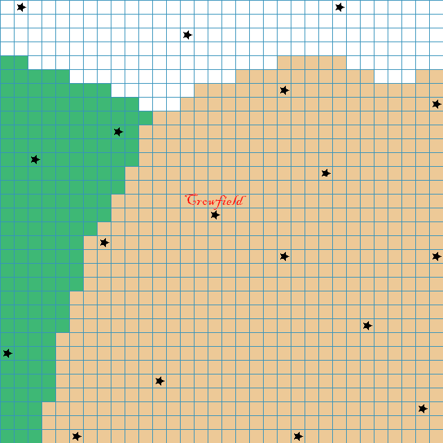
Last week we talked about the map around Crowfield. I drew up a quick sketch in Gimp. It still needs rivers and roads and such. And mountains. Mountains surround the Firelands.
The Frostlands are actually on a very tall plateau (thus the snow may have more to do with altitude than latitude). They are surrounded by maddeningly tall, sheer cliffs.
And there are non-settlement things (like ruins and lairs) to place on the map.
Anyway, the tan color represents the Firelands, white for the Frostlands, and the green is the Dreadwood. The stars mark settlements, and the one in the center is Crowfield.
The two maps are identical other than the grid (or lack thereof).
First without the grid:

And now with:
Thoughts?
Appreciate the visuals! It's neat to see the layout!
ReplyDeleteMy one curiosity presently is a follow-up to my comment on last week's post; namely if the ruins and such would 'replace' one of the settlement stars, or if such locales would be separate from the indicated settlements?
I don't think one is superior over the other, just a wondering.
Settlements are towns, villages, cities, encampments, temples, castles, etc.
DeleteRuins, lairs, dungeons, etc. will be separate/additional locations. They're things to stumble across :)